Note: All photos can be seen at higher resolution by downloading. In most browsers this is accomplished by right-clicking on the photo and then selecting an option such as "Save Picture As" (Windows) or "Save Image to" (Mac OS X). With a single button mouse, control-clicking (holding the CTRL key while clicking) usually is equivalent.
On September 10, I had flown to Minden, Nevada, for what was supposed to be a three day soaring adventure. The next day was September 11, the FAA grounded all air traffic, the trip was cut short, and I drove home. Shaken by the loss of life, I decided to drive home through Yosemite instead of taking the more direct route. I have always found Yosemite to have a healing effect when life's troubles seem overwhelming as they certainly did on that day. Yosemite worked its magic, and I arrived home in much better shape.
While flight in the Bay Area was impossible for a significantly longer time, within two weeks, the restrictions were loosened in areas like Minden that were sparsely populated and therefore unlikely terrorist targets. Hence on October 10, I was able to fly out of Minden and took these three pictures of Lake Tahoe.
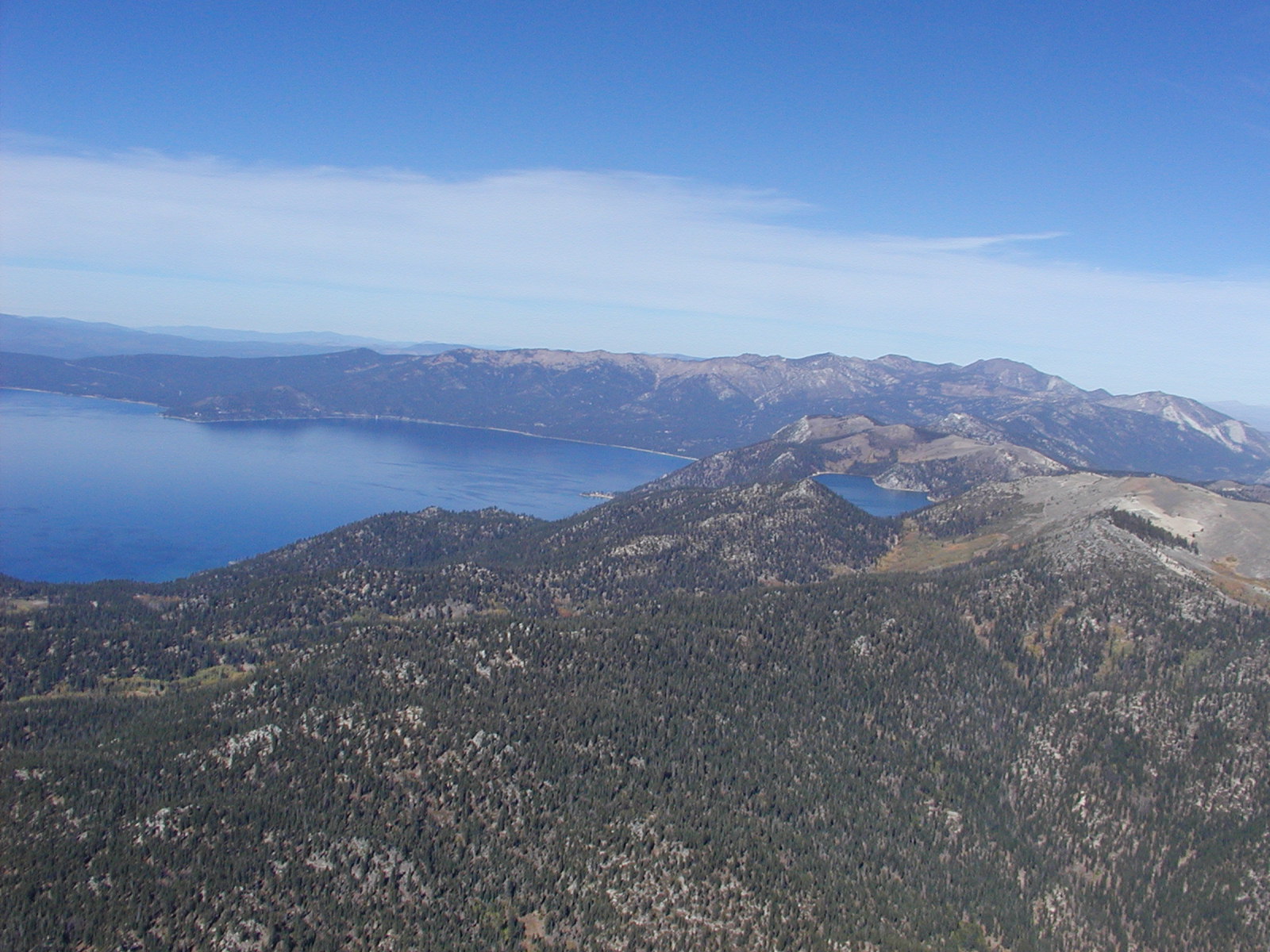
The picture above was taken over the Carson Range, the part of the Sierras that form the east wall of Lake Tahoe, and also shows the smaller Marlette Lake. In the late nineteenth century, an inverted siphon was built to transport water from Marlette Lake (7800') to Virginia City's silver mines. At its bottom on the Carson Valley floor, the inverted siphon experienced water pressure of well over 1000 psi.
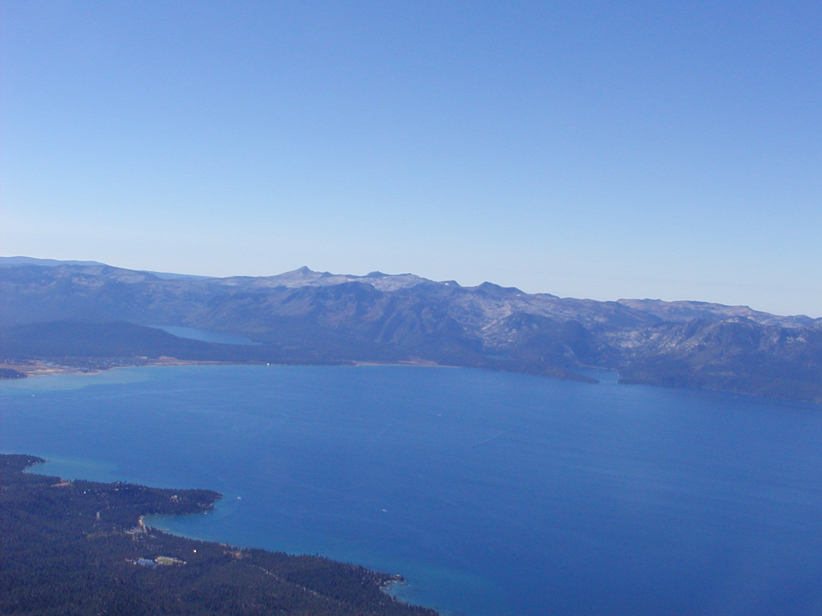
This wide angle picture was also taken from the east side of Lake Tahoe, but now looking southwest. Emerald Bay is clearly visible about one-quarter of the way from the right side of the photo, Cascade Lake is immediately to the left, and the larger lake about two-thirds of the way to the left side of the photo is Fallen Leaf Lake. Tahoe Keys is visible at the left edge of the picture, but the rest of South Shore Tahoe is cut off.
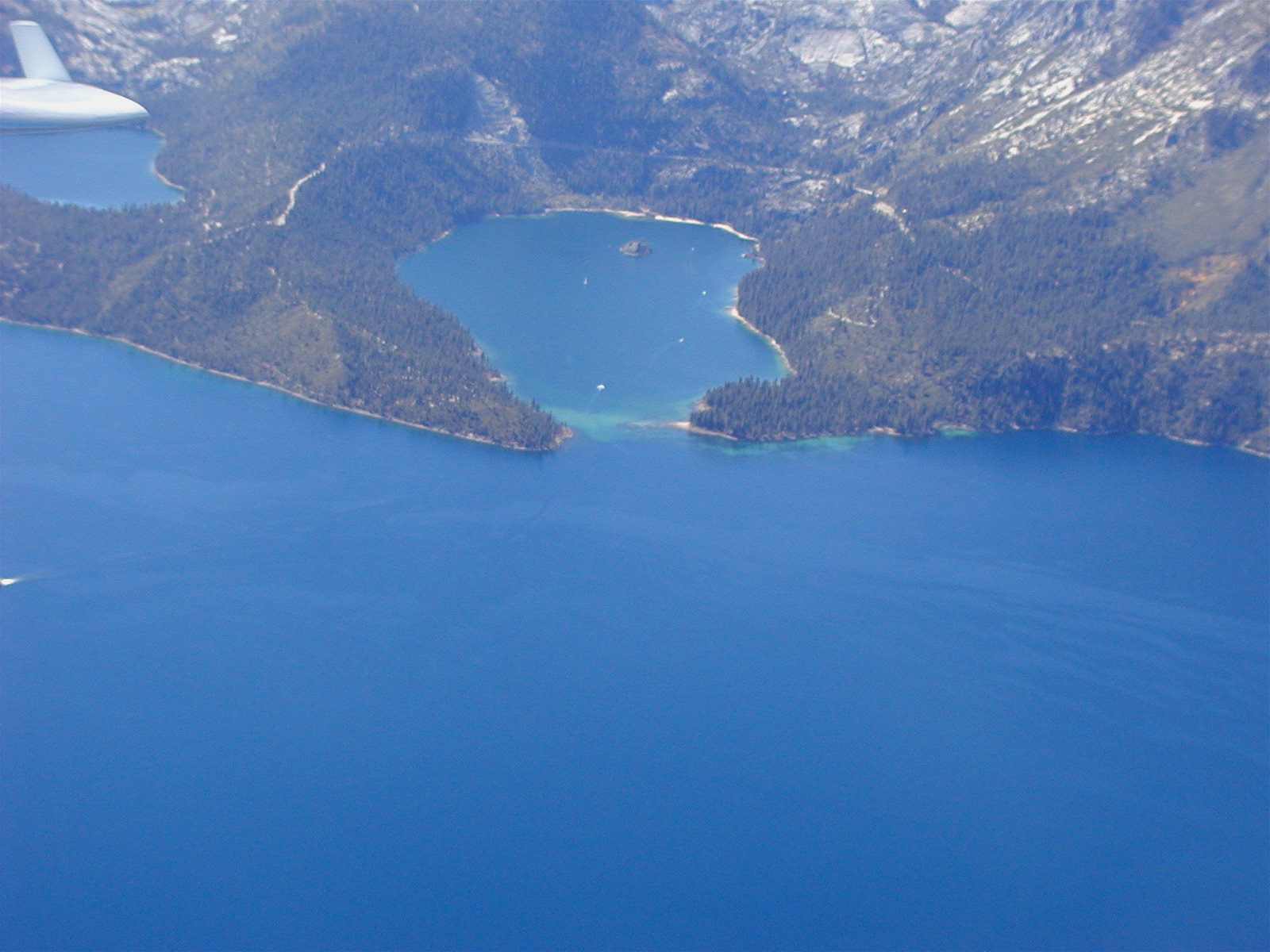
This is a close up of Emerald Bay and Fannette Island on Tahoe's west shore. Cascade Lake is just under my wing and Highway 89 can be seen painfully snaking its way back and forth between Cascade Lake and Emerald Bay before going around Emerald Bay.