Note: All photos can be seen at higher resolution by downloading. In most browsers this is accomplished by right-clicking on the photo and then selecting an option such as "Save Picture As" (Windows) or "Save Image to" (Mac OS X). With a single button mouse, control-clicking (holding the CTRL key while clicking) usually is equivalent.
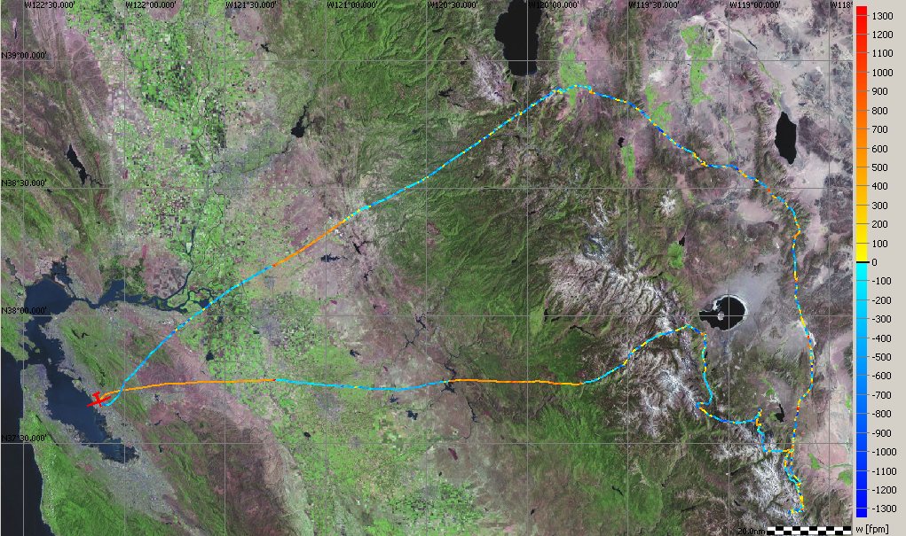
This flight, depicted on the map below, was a one-day trip from my home base at Hayward, on the east side of San Francisco Bay, to the Sierras and back. (San Francisco Bay is on the left side of the map.) The Stemme S10VT is uniquely capable of a flight like this due to its combination of excellent soaring and power performance. Its 23 meter (75.5') wingspan, retractable propeller, retractable main gear, and flaps that go to -10 degrees for high speed cruise provide almost unparalleled soaring performance, while its turbocharged engine allowed me to climb from sea level to 13,000 feet in 25 minutes in the first engine run out of Hayward. Some other motor gliders match or slightly exceed the S10VT in either soaring or power performance, but none comes close on both counts.
The flight trace was obtained from a data logger installed in the glider which records my position and altitude every twelve seconds. A software package SeeYou provides numerous ways to analyze the flight. Here, the flight trace is color coded to show my rate of climb or sink. Hotter colors (yellow, orange and red) indicate faster climb and cooler colors (deeper shades of blue) indicate faster sink. The three portions of solid orange (climb) correspond to three engine runs and the shorter regions of climb indicate thermals or other natural lift. The flight lasted 6.5 hours and used 1.1 engine hours and 7 gallons of fuel. To have driven an approximation of this trip by car would have taken 15 hours plus rest stops and burned 24 gallons of fuel, assuming 30 mpg.
I crossed the Sierras at Yosemite, going almost to Mono Lake (the rounded lake on the right side of the map with an island in its center). I then flew 70 miles southeast, mostly following the Sierras, but retreating twice to the valley east of the Sierras when I lost too much altitude to stay on top. Fortunately, I found enough lift to get back on the Sierras each time. I then turned around and flew 150 miles north, now on mountains east of the Sierras and not as visible on the map since they have less snowpack. Finally, I crossed the Sierras just south of Lake Tahoe for the trip home.
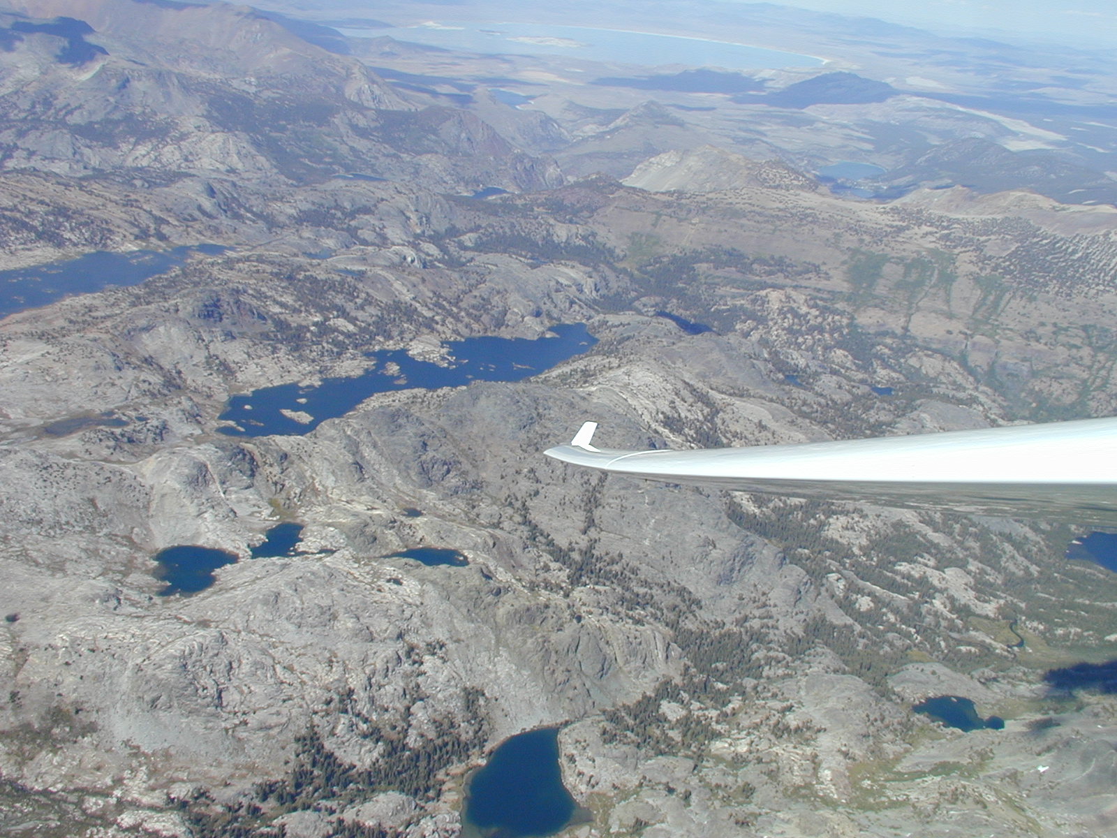
The photo above was taken on August 29, a month after all the other photos, but was included to show the location of the smaller lakes relative to Mono Lake, visible in the distance at top center. It was taken in the Ansel Adams Wilderness Area, just south of Yosemite National Park and also shows
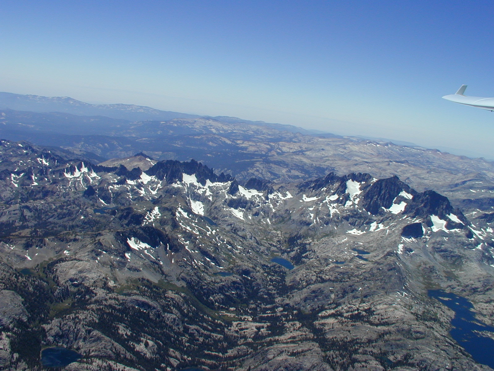
This photo was taken from 16,900 feet, flying south-southeast. Banner Peak (12,945 feet) and Mt. Ritter (13,157 feet) are at the right hand side with Banner slightly closer. Most of Garnet Lake is at the lower right corner of the photo, with the three small Nydiver Lakes above and to the left, below Mt. Ritter. Ediza Lake is the mid-size lake near the center of the picture, with Cabin Lake to the left of Ediza. The Minarets are the saw tooth peaks above and to the left of Ediza and Cabin Lakes. The glaciers on the Minarets feed Iceberg Lake and a stream from Iceberg feeds Ediza.
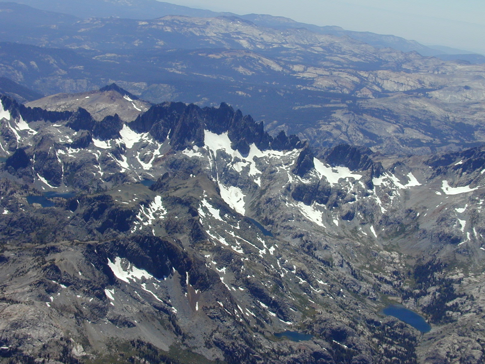
This photo is taken from 16,800 feet and from almost the same location as the previous picture, but is zoomed in to better show the Minarets. Lake Ediza is at the lower right corner. Moving slightly to the left is Cabin Lake , near the bottom center of the picture. Iceberg and Cecile Lakes are both below the Minarets, with Iceberg being more to the right and draining into Ediza via a long canyon. Cecile Lake drains into Iceberg, but the creek's passage is hidden by Volcanic Ridge, which also partly hides both Iceberg and Cecile Lakes. Minaret Lake is near the left hand edge of the picture, slightly above center.

This wide angle shot shows (R to L) Thousand Island and Garnet Lakes, the three small Nydiver Lakes, Ediza Lake, and Cabin Lake. Banner Peak and Mt. Ritter are in the center of the photo. As with all these photos, you can right or control click on the photo to download to your desktop and view it in higher resolution.
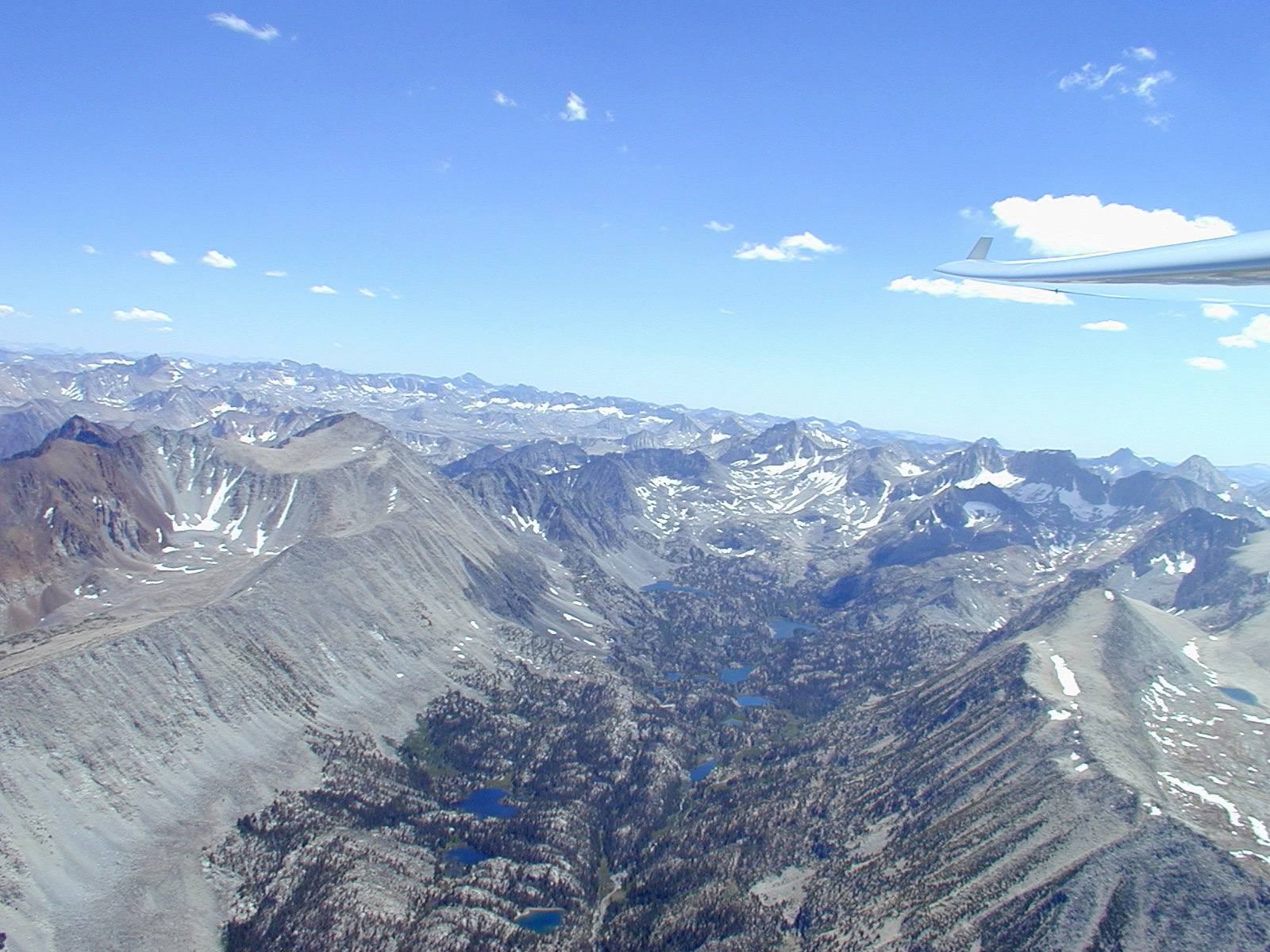
The Sierras about five miles south of Mammoth Lakes ski area, flying east at 15,000 feet, looking south.
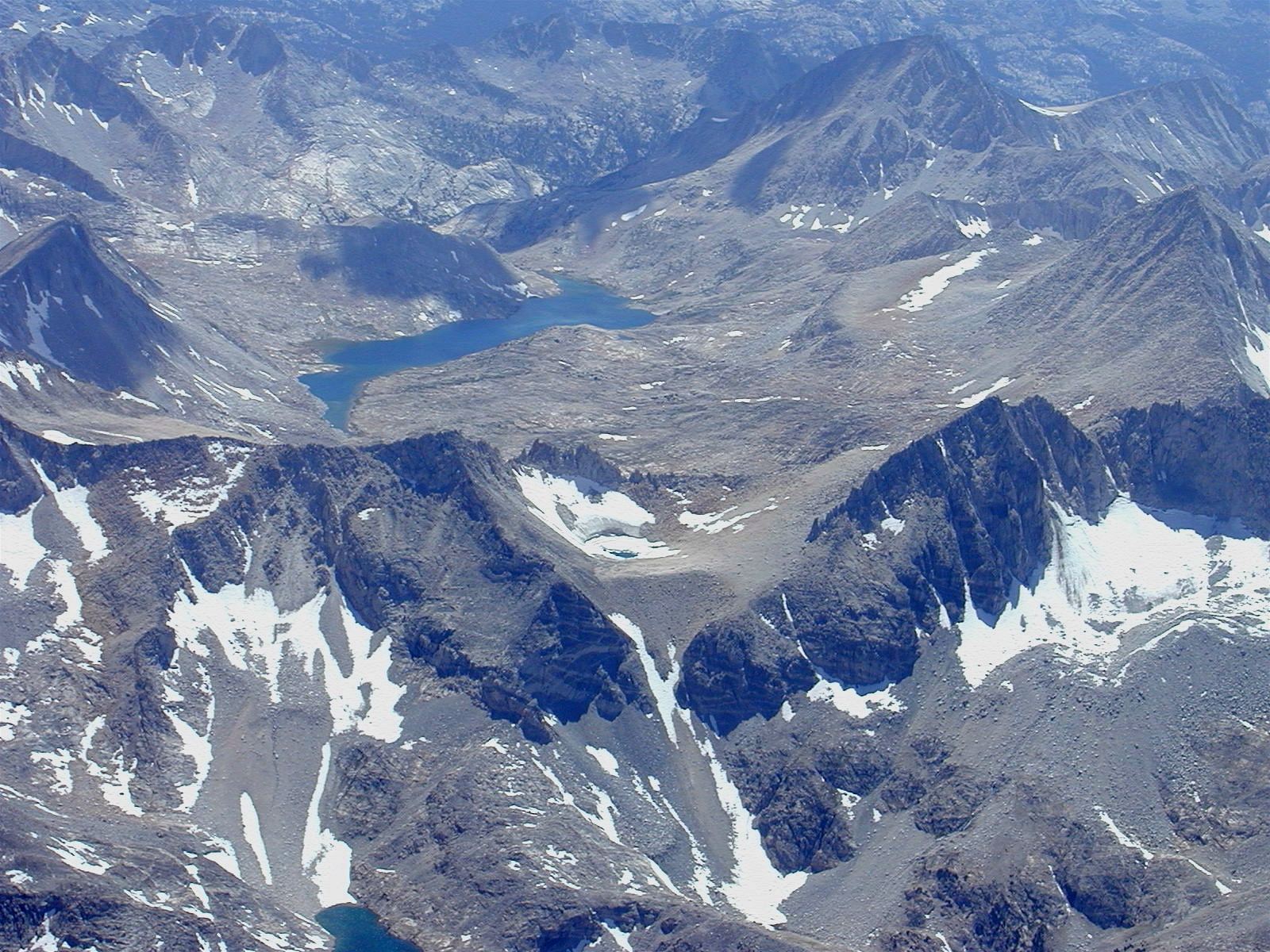
Lake Italy, clearly named for its boot-like shape, is at an elevation of 11,200 feet and west of Bishop, California, on the eastern flank of the Sierras. This picture was taken from 17,500 feet, flying almost due south, looking west. Note the small frozen lake in the center of the picture.
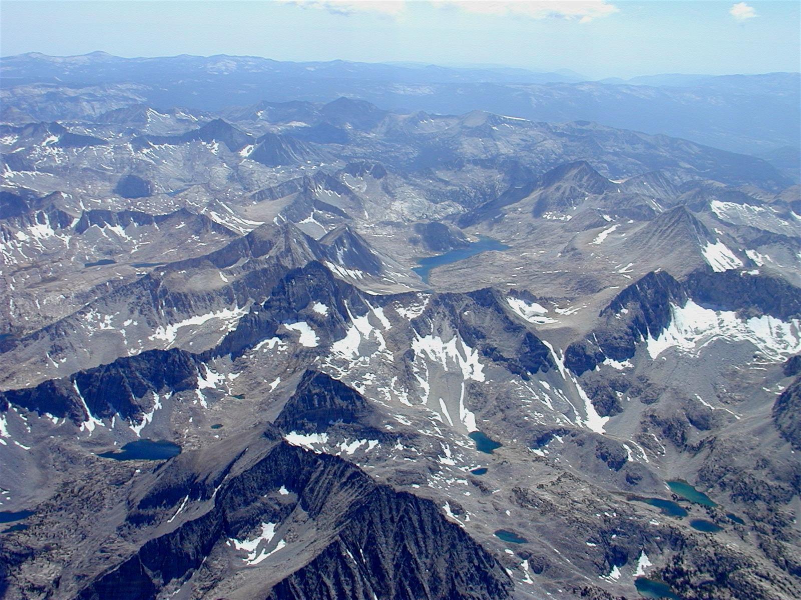
The same location as the last picture, but now zoomed out showing more of Lake Italy's surroundings.
Return to Soaring Photo Links Page
Return to Martin Hellman's Home Page